
Oftentimes when conducting Phase I Environmental Site Assessments or Preliminary Assessments (in New Jersey) you run into some interesting bits of information…you just need to know where to look, and who to ask. Sanborn Maps and Property Record Cards usually have some Easter Eggs hidden in them. Other times you hit roadblocks, or have to deal with cantankerous individuals, but either way it’s always an adventure (even for the supposedly easy projects).
For this new series, we’ll unearth some obscure finds and possibly a tip or two…just to keep the brain stimulated!
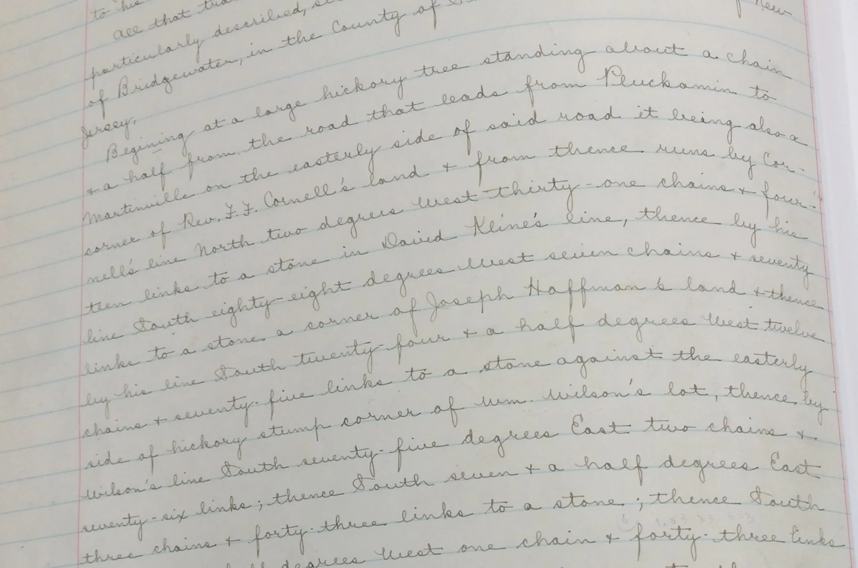
In this first volume, what was expected to be a relatively easy review of a property’s ownership history, turned into a hunting expedition into several deed books at the County offices. A couple of hours later, some answers were identified, along with some excellent passages from a 1913 survey (old “metes & bounds”) that was included in the deed:
The first sentence of the main paragraph was great: Beginning at a large hickory tree standing about a chain + a half from the road that leads from … Looking further down you get this: …from thence runs by Cornell’s line north two degrees west thirty-one chains + four then links to stone in David Kline’s line…
Now, I’m not a surveyor, so I did some quick research and compared some old files & figures…prior to conducting my site visit. The key factor here? A chain’s length = 66feet. Why would I ever know that?
When I brought this info to the field along with a current tax map, I was then able to (with a little bit of head scratching) locate a spectacular 100 year old hickory tree and eventually one of my site’s corners. Not the most exact for my purposes, but a great start. (Note: finding the “stone” or any stone for that matter was less successful, but not unexpected). As we all know, understanding “off and on-site” is pretty important, so a couple of measurements were taken just to confirm the findings which were surprisingly (still) accurate, and then off I went to locate the other property corners and eventually complete my perimeter inspection. A little time consuming (more so from the hilly terrain), but the old information from that deed was quite useful. There are a number of useful tips from this particular effort, but, here are a couple that stood out from this phase of the work:
1. Utilize all sources to confirm property lines (especially in a wooded area with a general lack of controls).
2. Attempt to confirm “old” information / measurement as inaccuracies are common.
3. Know how to use a compass. Most smartphones have them…but do you know how to “use” it for field purposes?
4. Dust off your field guide on tree identification!
(disclaimer: if the identification of property lines are critical to your project, consider asking your surveyor for a little help.)
Stay tuned for future Phase I ESA tips and tidbits in the upcoming weeks…as there are plenty of lessons and unique observations to be shared, which could ultimately make our jobs easier! We hope that you find these posts informative, and relatively useful, and your feedback is always welcome. For further information please don't hesitate to contact us at tfrancis@cardinallsrp.com, or www.cardinalLSRP.com.